
COSTA VICENTINA

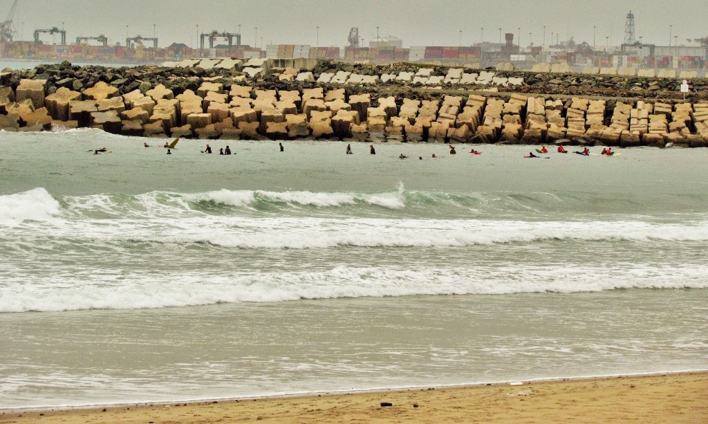
Southwest Alentejo Natural Park and Costa Vicentina are located on the southwest coast of Portugal, between the Ribeira da Junqueira, in São Torpes, and Burgau beach, with an extension of 110 km, in a total area of 89,595 hectares, corresponding to the land area of 56 952.79 hectares and the marine area adjacent to 17 461.21 hectares. It covers the southwest coast of mainland Portugal, in the south of the Alentejo coast, and in the western Algarve around Cabo de São Vicente. Includes parish territories from the following counties and districts: Setúbal District; Sines (parishes of Porto Covo and Sines); District of Beja; Odemira (parishes of Longueira / Almograve, Santa Maria, São Luís, São Salvador, São Teotónio, Vila Nova de Milfontes and Zambujeira do Mar); Faro District; Aljezur (parishes of Aljezur, Bordeira, Odeceixe and Rogil); Vila do Bispo (parishes of Budens, Raposeira, Sagres and Vila do Bispo). In addition to the coastal strip and the underwater zone of 2 km from the coast, the park includes the valley of the River Mira from the mouth to the village of Odemira. In the natural park area, there are several types of landscapes and natural and semi-natural habitats, such as steep cliffs and cliffs, beaches, several islets and reefs (including the island of Pessegueiro and an unusual coral reef in Carrapateira), the estuary Mira, Cabo Sardão, the promontory of Sagres and Cabo de São Vicente, dune systems, heaths, salt marshes, salty steppes, temporary lagoons, ravines (valleys embedded with dense vegetation cover), etc. The maximum altitudes are: 324 m, inland (in São Domingos, Odemira); and 156 m, on the coast (in Torre de Aspa, Vila do Bispo). The maximum depth is 32 m, 2 km off the Pontal da Carrapateira (Aljezur). Climate The climate is the Mediterranean, but with a strong maritime influence. Temperatures remain mild throughout the year except during periods of rising winds when they can rise or fall precipitously. The wind regime is an important factor in the region's climate. The dominant winds are those in the northern quadrant. Southwest winds sometimes occur, especially in winter, while rising winds occur with low incidence throughout the year. On summer afternoons, intense sea breezes and heavy humidity are common. Temperatures rise from north to south; annual averages are 16/17 ° C in Monte Velho and Sines and 17/18 ° C in Vila do Bispo and Sagres, in summer (June to September) monthly averages are around 20-23 ° and in winter (December to February) the 11th / 13th with annual peaks that can vary between the 4th (inland in January) and the 40th in July. The area of the Sagres promontory has the smallest thermal amplitude in mainland Portugal. Maximum precipitation occurs in December, with average annual values between 400 mm, in the Sagres area and 600/800 mm, in the interior mountains and the rest of the coast north of Odeceixe. In general, it rains further north and inland (mountainous area), the rainy season is fixed between November and April. The rainfall has a torrential character typical of the south of the country and the rest of the Mediterranean areas. Fogs are not very frequent, occurring only on certain days of the year, but the humidity in the air usually remains high, even in warmer periods. The average annual heat stroke is very high, among the highest in the country and in Europe. The sea is, as a general rule, rougher than that of the Algarve, but calmer than that of the coast to the north of Cabo Raso, the wave predominates NW / WNW with 2 m. When strong depression systems approach the coast or reach it directly, in the winter period, W / SW storms with waves of up to 10 m can occur. The seawater is very rich in biodiversity and pure but also fresh, given the frequent upwelling, with the temperature varying between 14 / 15º in February and 20 / 21º in September.
Human Presence.
The resident population is about 24 thousand people. Visitors, in at least some areas of the park, are about 2.8 million per year.
The area of the Natural Park of Southwest Alentejo and Costa Vicentina encompasses several towns and villages. Over the centuries the population has been dedicated to fishing and agriculture and livestock, but tourism is an increasingly important activity, particularly in places like Porto Covo and Vila Nova de Milfontes and across the Algarve coast of the park. The industrial sector is practically nonexistent.
The main tourist activities are hiking, orientation, climbing, paragliding, horseback riding, canoeing, surfing, windsurfing, diving, and mountain biking.
Some villages and sites in the park have great historical and cultural interest, with several national monuments and buildings classified as public interest, with special emphasis on the area of Sagres and Cabo de São Vicente.
The main threats to the park's biodiversity are greenhouses and grass plantations on the coast and inland eucalyptus plantations. It should also be noted that the large industrial activity in Sines, and the enlargement of its port, also influence the area's air and water quality.
The Vincentian Route
Rota Vicentina - Association for the Promotion of Nature Tourism on the Alentejo and Vicentina Coast, is a non-profit association that, since 2013, has been responsible for the management, integration, encouragement, development, and promotion of the walking trails of the Rota Vicentina, inserted in the Natural Park of the Southwest Alentejo and Costa Vicentina, as well as the tourist offer associated with the tourist product that the Rota Vicentina represents.
The beauty of the landscape, the natural, historical, and cultural heritage, the tourist resources, and the public nature of the paths, were the main criteria followed in the process of choosing the route, composed of existing paths and formed by the Historical Path, Fishermen's Trail and several Circular Routes, itineraries that complement each other revealing the true essence of the Southwest of Portugal.
In 2019, Rota Vicentina expanded its offer also counting on a system of more than 1000 km of BTT routes, a Touring Bike route that joins the airports of Lisbon and Faro, and several Nature, Culture, and Wellness activities.


AREA NORTH OF PORTO COVO
37.86092º N; 8.79352º W


ROTA VICENTINA

💓💓💓💓💓
SEARCH IN ALPHABETICAL ORDER
IN THE DISTRICT OF SETUBAL

💓💓💓💓💓
Return to mainland Portugal &
the Azores and Madeira islands

